← back
The GCMD vocabulary is developed and maintained by:
Olsen, L.M., G. Major, K. Shein, J. Scialdone, S. Ritz, T. Stevens, M. Morahan, A. Aleman, R. Vogel, S. Leicester, H. Weir, M. Meaux, S. Grebas, C.Solomon, M. Holland, T. Northcutt, R. A. Restrepo, R. Bilodeau, 2013. NASA/Global Change Master Directory (GCMD) Earth Science Keywords. Version 8.0.0.0.0 ← back Released Dataset Stress Map Germany 2016 Cite as: Copy citation to clipboard Reiter, Karsten; Heidbach, Oliver; Müller, Birgit; Reinecker, John; Röckel, Thomas (2016): Stress Map Germany 2016. GFZ Data Services. https://doi.org/10.5880/WSM.Germany2016_en Status I N R E V I E W :
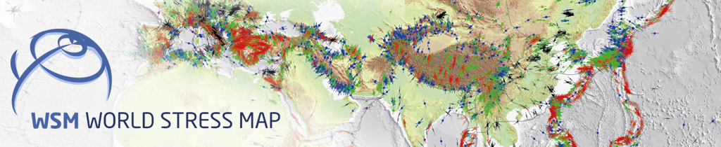
Additional Information The World Stress Map (WSM) is a global compilation of information on the crustal present-day stress field. It is a collaborative project between academia and industry that aims to characterize the stress pattern and to understand the stress sources. It commenced in 1986 as a project of the International Lithosphere Program under the leadership of Mary-Lou Zoback. From 1995-2008 it was a project of the Heidelberg Academy of Sciences and Humanities headed first by Karl Fuchs and then by Friedemann Wenzel. Since 2009 the WSM is maintained at the GFZ German Research Centre for Geosciences and since 2012 the WSM is a member of the ICSU World Data System. All stress information is analysed and compiled in a standardized format and quality-ranked for reliability and comparability on a global scale. Authors Reiter, Karsten ;Technical University Darmstadt, GermanyHeidbach, Oliver ;GFZ German Research Centre of Geosciences, Potsdam, GermanyMüller, Birgit;KIT Institut für Angewandte Geowissenschaften, Karlsruhe, Germany Reinecker, John;GeoThermal Engineering, Karlsruhe, Germany Röckel, Thomas;Piewak & Partner, Ingenieurbüro für Hydrogeologie und Umweltschutz, Bayreuth, Germany Contact Contributors GFZ German Research Centre of Geosciences
Keywords crustal stress, in situ stress, tectonic stress, crustal stress pattern, World Stress Map, geophysics, tectonics More Metadata datacite:
download xml
resource (xsi:schemaLocation=http://datacite.org/schema/kernel-4 http://schema.datacite.org/meta/kernel-4.3/metadata.xsd)identifier (identifierType=DOI): 10.5880/WSM.Germany2016_en creatorscreatorcreatorName: Reiter, Karsten nameIdentifier (nameIdentifierScheme=ORCID): 0000-0003-4232-7426 affiliation: Technical University Darmstadt, Germany creatorcreatorName: Heidbach, Oliver nameIdentifier (nameIdentifierScheme=ORCID): 0000-0001-8009-5422 affiliation: GFZ German Research Centre of Geosciences, Potsdam, Germany creatorcreatorName: Müller, Birgit affiliation: KIT Institut für Angewandte Geowissenschaften, Karlsruhe, Germany creatorcreatorName: Reinecker, John affiliation: GeoThermal Engineering, Karlsruhe, Germany creatorcreatorName: Röckel, Thomas affiliation: Piewak & Partner, Ingenieurbüro für Hydrogeologie und Umweltschutz, Bayreuth, Germany titlestitle: Stress Map Germany 2016 publisher: GFZ Data Services subjectssubject: crustal stress pattern subject: World Stress Map subject (subjectScheme=NASA/GCMD Earth Science Keywords): EARTH SCIENCE > SOLID EARTH > TECTONICS > PLATE TECTONICS > LITHOSPHERIC PLATE MOTION > PLATE MOTION DIRECTION subject (subjectScheme=NASA/GCMD Earth Science Keywords): EARTH SCIENCE > SOLID EARTH > TECTONICS > PLATE TECTONICS > STRESS subject (subjectScheme=NASA/GCMD Earth Science Keywords): EARTH SCIENCE SERVICES > DATA MANAGEMENT/DATA HANDLING > DATA SEARCH AND RETRIEVAL subject (subjectScheme=GEMET - INSPIRE themes, version 1.0): geophysics subject (subjectScheme=GEMET - INSPIRE themes, version 1.0): tectonics contributorscontributor (contributorType=ContactPerson)contributorName: Reiter, Karsten nameIdentifier (nameIdentifierScheme=ORCID): 0000-0003-4232-7426 affiliation: Technical University Darmstadt, Germany contributor (contributorType=Editor)contributorName: Reiter, Karsten nameIdentifier (nameIdentifierScheme=ORCID): 0000-0003-4232-7426 affiliation: Technical University Darmstadt, Germany contributor (contributorType=ProjectLeader)contributorName: Heidbach, Oliver nameIdentifier (nameIdentifierScheme=ORCID): 0000-0001-8009-5422 affiliation: GFZ German Research Centre of Geosciences, Potsdam, Germany contributor (contributorType=ProjectMember)contributorName: Müller, Birgit affiliation: KIT Institut für Angewandte Geowissenschaften, Karlsruhe, Germany contributor (contributorType=ProjectMember)contributorName: Reinecker, John affiliation: GeoThermal Engineering, Karlsruhe, Germany contributor (contributorType=ProjectMember)contributorName: Röckel, Thomas affiliation: Piewak & Partner, Ingenieurbüro für Hydrogeologie und Umweltschutz, Bayreuth, Germany contributor (contributorType=HostingInstitution)contributorName: GFZ German Research Centre of Geosciences contributor (contributorType=ContactPerson)contributorName: Reiter, Karsten affiliation: Technical University Darmstadt, Germany datesdate (dateType=Created): 2016-11-03 resourceType (resourceTypeGeneral=Dataset): Dataset relatedIdentifiersrelatedIdentifier (relatedIdentifierType=URL relationType=IsCompiledBy): http://www.world-stress-map.org relatedIdentifier (relatedIdentifierType=URL relationType=IsDocumentedBy): http://gfzpublic.gfz-potsdam.de/pubman/faces/viewItemOverviewPage.jsp?itemId=escidoc:1361435 relatedIdentifier (relatedIdentifierType=DOI relationType=IsDocumentedBy): 10.1016/j.tecto.2009.07.023 relatedIdentifier (relatedIdentifierType=DOI relationType=IsDocumentedBy): 10.1144/GSL.SP.2003.212.01.07 relatedIdentifier (relatedIdentifierType=DOI relationType=IsDerivedFrom): 10.5880/wsm.2016.001 relatedIdentifier (relatedIdentifierType=DOI relationType=IsVariantFormOf): 10.5880/WSM.Germany2016 rightsListrights (rightsURI=http://creativecommons.org/licenses/by/4.0/): CC BY 4.0 descriptionsdescription (descriptionType=Abstract) description (descriptionType=Other) geoLocationsgeoLocationgeoLocationPlace: Germany iso19115:
download xml
MD_Metadata (xsi:schemaLocation=http://www.isotc211.org/2005/gmd http://www.isotc211.org/2005/gmd/gmd.xsd)fileIdentifierCharacterString: 10.5880/WSM.Germany2016_en languageLanguageCode (codeList=http://www.loc.gov/standards/iso639-2/ codeListValue=eng): eng characterSetMD_CharacterSetCode (codeListValue=utf8 codeList=http://www.isotc211.org/2005/resources/codeList.xml#MD_CharacterSetCode): hierarchyLevelMD_ScopeCode (codeList=http://www.isotc211.org/2005/resources/Codelist/gmxCodelists.xml#MD_ScopeCode codeListValue=dataset): dataset contactCI_ResponsiblePartyorganisationNameCharacterString: GFZ German Research Centre for Geosciences contactInfoCI_ContactaddressCI_AddresselectronicMailAddressCharacterString: datapub(_at_)gfz-potsdam.de onlineResourceCI_OnlineResourcelinkageURL: http://www.gfz-potsdam.de nameCharacterString: Helmholtz-Centre Potsdam - GFZ German Research Centre for Geosciences descriptionCharacterString: Helmholtz-Centre Potsdam - GFZ German Research Centre for Geosciences roleCI_RoleCode (codeList=http://www.isotc211.org/2005/resources/Codelist/gmxCodelists.xml#CI_RoleCode codeListValue=pointOfContact): pointOfContact referenceSystemInfoMD_ReferenceSystemreferenceSystemIdentifierRS_IdentifiercodeCharacterString: urn:ogc:def:crs:EPSG:4326 identificationInfoMD_DataIdentificationcitationCI_CitationtitleCharacterString: Stress Map Germany 2016 dateCI_DatedateTypeCI_DateTypeCode (codeList=http://www.isotc211.org/2005/resources/Codelist/gmxCodelists.xml#CI_DateTypeCode codeListValue=revision): revision dateCI_DatedateTypeCI_DateTypeCode (codeList=http://www.isotc211.org/2005/resources/Codelist/gmxCodelists.xml#CI_DateTypeCode codeListValue=creation): creation identifierMD_IdentifiercodeCharacterString: doi:10.5880/WSM.Germany2016_en citedResponsibleParty (xlink:href=http://orcid.org/0000-0003-4232-7426)CI_ResponsiblePartyindividualNameCharacterString: Reiter, Karsten organisationNameCharacterString: Technical University Darmstadt, Germany roleCI_RoleCode (codeList=http://www.isotc211.org/2005/resources/Codelist/gmxCodelists.xml#CI_RoleCode codeListValue=author): author citedResponsibleParty (xlink:href=http://orcid.org/0000-0001-8009-5422)CI_ResponsiblePartyindividualNameCharacterString: Heidbach, Oliver organisationNameCharacterString: GFZ German Research Centre of Geosciences, Potsdam, Germany roleCI_RoleCode (codeList=http://www.isotc211.org/2005/resources/Codelist/gmxCodelists.xml#CI_RoleCode codeListValue=author): author citedResponsiblePartyCI_ResponsiblePartyindividualNameCharacterString: Müller, Birgit organisationNameCharacterString: KIT Institut für Angewandte Geowissenschaften, Karlsruhe, Germany roleCI_RoleCode (codeList=http://www.isotc211.org/2005/resources/Codelist/gmxCodelists.xml#CI_RoleCode codeListValue=author): author citedResponsiblePartyCI_ResponsiblePartyindividualNameCharacterString: Reinecker, John organisationNameCharacterString: GeoThermal Engineering, Karlsruhe, Germany roleCI_RoleCode (codeList=http://www.isotc211.org/2005/resources/Codelist/gmxCodelists.xml#CI_RoleCode codeListValue=author): author citedResponsiblePartyCI_ResponsiblePartyindividualNameCharacterString: Röckel, Thomas organisationNameCharacterString: Piewak & Partner, Ingenieurbüro für Hydrogeologie und Umweltschutz, Bayreuth, Germany roleCI_RoleCode (codeList=http://www.isotc211.org/2005/resources/Codelist/gmxCodelists.xml#CI_RoleCode codeListValue=author): author citedResponsiblePartyCI_ResponsiblePartyindividualNameCharacterString: GFZ German Research Centre of Geosciences roleCI_RoleCode (codeList=http://www.isotc211.org/2005/resources/Codelist/gmxCodelists.xml#CI_RoleCode codeListValue=originator): originator citedResponsiblePartyCI_ResponsiblePartyorganisationNameCharacterString: GFZ Data Services roleCI_RoleCode (codeList=http://www.isotc211.org/2005/resources/Codelist/gmxCodelists.xml#CI_RoleCode codeListValue=publisher): publisher abstractCharacterString: The stress map of Germany shows the orientation of the current maximum horizontal stress (SHmax) in the earth's crust. Assuming that the vertical stress (SV) is a principal stress, SHmax defines the orientation of the 3D stress tensor; the minimum horizontal stress Shmin is than perpendicular to SHmax. In the stress map the SHmax orientations are represented as lines of different lengths. The length of the line is a measure of the quality of data and the symbol shows the stress indicator and the color the stress regime. Data with E-Quality are shown without additional information as dots on the map. The stress data are freely available and part of the World Stress Map (WSM) project. For more information about the data and criteria of data analysis and quality mapping are plotted along the WSM website at http://www.world-stress-map.org.
The German version of the World Stress Map Germany is available via http://doi.org/10.5880/WSM.Germany2016. statusMD_ProgressCode (codeList=http://www.isotc211.org/2005/resources/Codelist/gmxCodelists.xml#MD_ProgressCode codeListValue=Complete): Complete pointOfContactCI_ResponsiblePartyindividualNameCharacterString: Reiter, Karsten organisationNameCharacterString: Technical University Darmstadt, Germany positionNameCharacterString: Senior Researcher contactInfoCI_ContactaddressCI_AddresselectronicMailAddressCharacterString: reiter(_at_)geo.tu-darmstadt.de roleCI_RoleCode (codeList=http://www.isotc211.org/2005/resources/Codelist/gmxCodelists.xml#CI_RoleCode codeListValue=pointOfContact): pointOfContact descriptiveKeywordsMD_KeywordskeywordCharacterString: crustal stress keywordCharacterString: in situ stress keywordCharacterString: tectonic stress keywordCharacterString: crustal stress pattern keywordCharacterString: World Stress Map descriptiveKeywordsMD_KeywordskeywordCharacterString: EARTH SCIENCE > SOLID EARTH > TECTONICS > PLATE TECTONICS > LITHOSPHERIC PLATE MOTION > PLATE MOTION DIRECTION keywordCharacterString: EARTH SCIENCE > SOLID EARTH > TECTONICS > PLATE TECTONICS > STRESS keywordCharacterString: EARTH SCIENCE SERVICES > DATA MANAGEMENT/DATA HANDLING > DATA SEARCH AND RETRIEVAL thesaurusNameCI_CitationtitleCharacterString: NASA/GCMD Earth Science Keywords dateCI_Datedate (gco:nilReason=missing): dateTypeCI_DateTypeCode (codeList=http://www.isotc211.org/2005/resources/Codelist/gmxCodelists.xml#CI_DateTypeCode codeListValue=publication): publication descriptiveKeywordsMD_KeywordskeywordCharacterString: geophysics keywordCharacterString: tectonics thesaurusNameCI_CitationtitleCharacterString: GEMET - INSPIRE themes, version 1.0 dateCI_Datedate (gco:nilReason=missing): dateTypeCI_DateTypeCode (codeList=http://www.isotc211.org/2005/resources/Codelist/gmxCodelists.xml#CI_DateTypeCode codeListValue=publication): publication resourceConstraints (xlink:href=http://creativecommons.org/licenses/by/4.0/)MD_ConstraintsuseLimitationCharacterString: CC BY 4.0 resourceConstraintsMD_LegalConstraintsaccessConstraintsMD_RestrictionCode (codeList=http://www.isotc211.org/2005/resources/codeList.xml#MD_RestrictionCode codeListValue=otherRestrictions): otherConstraintsCharacterString: CC BY 4.0 resourceConstraintsMD_SecurityConstraintsclassificationMD_ClassificationCode (codeList=http://www.isotc211.org/2005/resources/codeList.xml#MD_ClassificationCode codeListValue=unclassified): aggregationInfoMD_AggregateInformationaggregateDataSetIdentifierRS_IdentifiercodeCharacterString: http://www.world-stress-map.org associationTypeDS_AssociationTypeCode (codeList=http://datacite.org/schema/kernel-4 codeListValue=IsCompiledBy): IsCompiledBy aggregationInfoMD_AggregateInformationaggregateDataSetIdentifierRS_IdentifiercodeCharacterString: http://gfzpublic.gfz-potsdam.de/pubman/faces/viewItemOverviewPage.jsp?itemId=escidoc:1361435 associationTypeDS_AssociationTypeCode (codeList=http://datacite.org/schema/kernel-4 codeListValue=IsDocumentedBy): IsDocumentedBy aggregationInfoMD_AggregateInformationaggregateDataSetIdentifierRS_IdentifiercodeCharacterString: 10.1016/j.tecto.2009.07.023 associationTypeDS_AssociationTypeCode (codeList=http://datacite.org/schema/kernel-4 codeListValue=IsDocumentedBy): IsDocumentedBy aggregationInfoMD_AggregateInformationaggregateDataSetIdentifierRS_IdentifiercodeCharacterString: 10.1144/GSL.SP.2003.212.01.07 associationTypeDS_AssociationTypeCode (codeList=http://datacite.org/schema/kernel-4 codeListValue=IsDocumentedBy): IsDocumentedBy aggregationInfoMD_AggregateInformationaggregateDataSetIdentifierRS_IdentifiercodeCharacterString: 10.5880/wsm.2016.001 associationTypeDS_AssociationTypeCode (codeList=http://datacite.org/schema/kernel-4 codeListValue=IsDerivedFrom): IsDerivedFrom aggregationInfoMD_AggregateInformationaggregateDataSetIdentifierRS_IdentifiercodeCharacterString: 10.5880/WSM.Germany2016 associationTypeDS_AssociationTypeCode (codeList=http://datacite.org/schema/kernel-4 codeListValue=IsVariantFormOf): IsVariantFormOf characterSetMD_CharacterSetCode (codeListValue=utf8 codeList=http://www.isotc211.org/2005/resources/codeList.xml#MD_CharacterSetCode): topicCategoryMD_TopicCategoryCode: geoscientificInformation distributionInfoMD_DistributiontransferOptionsMD_DigitalTransferOptionsonLineCI_OnlineResourcelinkageURL: http://doi.org/10.5880/WSM.Germany2016_en protocolCharacterString: WWW:LINK-1.0-http--link nameCharacterString: Data Access - DOI descriptionCharacterString: Data Access - DOI functionCI_OnLineFunctionCode (codeList=http://www.isotc211.org/2005/resources/Codelist/gmxCodelists.xml#CI_OnLineFunctionCode codeListValue=http://www.isotc211.org/2005/resources/Codelist/gmxCodelists.xml#CI_OnLineFunctionCode_information): information dataQualityInfoDQ_DataQualityscopeDQ_ScopelevelMD_ScopeCode (codeListValue=dataset codeList=http://www.isotc211.org/2005/resources/codeList.xml#MD_ScopeCode): Location Please, click on markers, line , bounding boxes or the list below to see related details in popup.
To explore to full geographic extent of the map please click and drag the map.
Dataset Description
Documented by
 Released
 Dataset
 Abstract
 ;Technical University Darmstadt, Germany
 Files
Files