Heidbach, Oliver; Liang, Wen-Tzong; Morawietz, Sophia; von Specht, Sebastian; Ma, Kuo-Fong (2022): Stress Map of Taiwan 2022. GFZ German Research Center for Geosciences. https://doi.org/10.5880/WSM.Taiwan2022
Status
I N R E V I E W : Heidbach, Oliver; Liang, Wen-Tzong; Morawietz, Sophia; von Specht, Sebastian; Ma, Kuo-Fong (2022): Stress Map of Taiwan 2022. GFZ German Research Center for Geosciences. https://doi.org/10.5880/WSM.Taiwan2022
Abstract
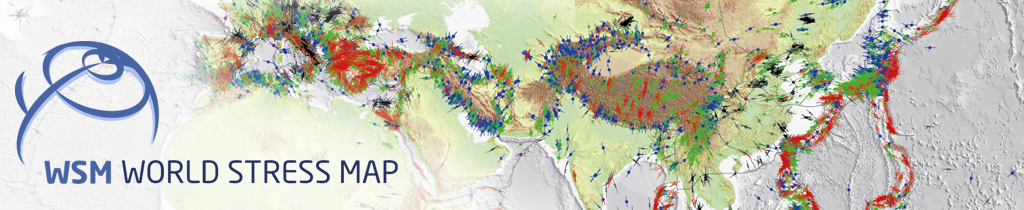
Stress maps show the orientation of the current maximum horizontal stress (SHmax) in the earth's crust. Assuming that the vertical stress (SV) is a principal stress, SHmax defines the orientation of the 3D stress tensor; the minimum horizontal stress Shmin is than perpendicular to SHmax. In stress maps SHmax orientations are represented as lines of different lengths. The length of the line is a measure of the quality of data and the symbol shows the stress indicator and the color the stress regime. The stress data are freely available and part of the World Stress Map (WSM) project. For more information about the data and criteria of data analysis and quality mapping are plotted along the WSM website at http://www.world-stress-map.org.
The stress map of Taiwan 2022 is based on the WSM database release 2016. However, all data records have been checked and we added a large number of new data from earthquake focal mechanisms from the national earthquake catalog and from publications. The total number of data records has increased from n=401 in the WSM 2016 to n=6,498 (4,234 with A-C quality) in the stress map of Taiwan 2022 The update with earthquake focal mechanims is even larger since another 1313 earthquake focal mechanism data records beyond the scale of this map have been added to the WSM database. The digital version of the stress map is a layered pdf file generated with GMT (Wessel et al., 2019). It also provide estimates of the mean SHmax orientation on a regular 0.1° grid using the tool stress2grid (Ziegler and Heidbach, 2019). Two mean SHmax orientations are estimated with search radii of r=25 and 50 km, respectively, and with weights according to distance and data quality. The stress map and data are available on the landing page at https://doi.org/10.5880/WSM.Taiwan2022 where further information is provided. The earthquake focal mechanism that are used for this stress map are provided by the Taiwan Earthquake Research Center (TEC) available at the TEC Data Center (https://tec.earth.sinica.edu.tw).
Additional Information
The World Stress Map (WSM) is a global compilation of information on the crustal present-day stress field. It is a collaborative project between academia and industry that aims to characterize the stress pattern and to understand the stress sources. It commenced in 1986 as a project of the International Lithosphere Program under the leadership of Mary-Lou Zoback. From 1995-2008 it was a project of the Heidelberg Academy of Sciences and Humanities headed first by Karl Fuchs and then by Friedemann Wenzel. Since 2009 the WSM is maintained at the GFZ German Research Centre for Geosciences and since 2012 the WSM is a member of the ICSU World Data System. All stress information is analysed and compiled in a standardized format and quality-ranked for reliability and comparability on a global scale.
Authors
Heidbach, Oliver;GFZ German Research Centre for Geosciences, Potsdam, Germany
Liang, Wen-Tzong;Institute of Earth Sciences, Academia Sinica, Taiwan
Morawietz, Sophia;GFZ German Research Centre for Geosciences, Potsdam, Germany
von Specht, Sebastian;Institute of Earth Sciences, Academia Sinica, Taiwan;Earthquake- Disaster & Risk Evaluation and Management Center, National Central University, Taiwan
Ma, Kuo-Fong;Institute of Earth Sciences, Academia Sinica, Taiwan;Earthquake- Disaster & Risk Evaluation and Management Center, National Central University, Taiwan
Contact
Heidbach, Oliver; GFZ German Research Centre for Geosciences, Potsdam, Germany;
CharacterString: Stress maps show the orientation of the current maximum horizontal stress (SHmax) in the earth's crust. Assuming that the vertical stress (SV) is a principal stress, SHmax defines the orientation of the 3D stress tensor; the minimum horizontal stress Shmin is than perpendicular to SHmax. In stress maps SHmax orientations are represented as lines of different lengths. The length of the line is a measure of the quality of data and the symbol shows the stress indicator and the color the stress regime. The stress data are freely available and part of the World Stress Map (WSM) project. For more information about the data and criteria of data analysis and quality mapping are plotted along the WSM website at http://www.world-stress-map.org.
The stress map of Taiwan 2022 is based on the WSM database release 2016. However, all data records have been checked and we added a large number of new data from earthquake focal mechanisms from the national earthquake catalog and from publications. The total number of data records has increased from n=401 in the WSM 2016 to n=6,498 (4,234 with A-C quality) in the stress map of Taiwan 2022 The update with earthquake focal mechanims is even larger since another 1313 earthquake focal mechanism data records beyond the scale of this map have been added to the WSM database. The digital version of the stress map is a layered pdf file generated with GMT (Wessel et al., 2019). It also provide estimates of the mean SHmax orientation on a regular 0.1° grid using the tool stress2grid (Ziegler and Heidbach, 2019). Two mean SHmax orientations are estimated with search radii of r=25 and 50 km, respectively, and with weights according to distance and data quality. The stress map and data are available on the landing page at https://doi.org/10.5880/WSM.Taiwan2022 where further information is provided. The earthquake focal mechanism that are used for this stress map are provided by the Taiwan Earthquake Research Center (TEC) available at the TEC Data Center (https://tec.earth.sinica.edu.tw).
pointOfContact
CI_ResponsibleParty
individualName
CharacterString: Heidbach, Oliver
organisationName
CharacterString: GFZ German Research Centre for Geosciences, Potsdam, Germany
CI_OnLineFunctionCode (codeList=http://www.isotc211.org/2005/resources/Codelist/gmxCodelists.xml#CI_OnLineFunctionCode codeListValue=http://www.isotc211.org/2005/resources/Codelist/gmxCodelists.xml#CI_OnLineFunctionCode_information): information
 Released
 Other
Other Abstract
 ;GFZ German Research Centre for Geosciences, Potsdam, Germany
 Files
Files